What to Expect
Enroute Flight Navigation is compatible with practically every traffic avoidance system on the market. After an initial one-time setup, you can expect that Enroute Flight Navigation automatically connects to your traffic data receiver as soon as you board your aircraft, power on the avionics and go flying. The figure Approaching EDTF with Traffic shows what the moving map will look like when traffic is detected.
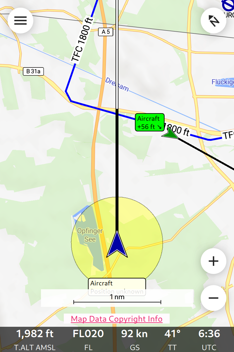
Approaching EDTF with Traffic
The figure shows two traffic factors.
There is one aircraft in the downwind section of the traffic circuit. The traffic has approximately the same altitude as your own aircraft and is descending. The green color indicates “no alarm”.
There is one aircraft nearby whose precise position is unknown to the traffic receiver; this is often the case with traffic that has only a Mode-S transponder. The traffic is most likely found within the yellow circle. The yellow color indicates that the traffic might be close enough to be dangerous.
The section Main Page and Moving Map covers the traffic display in detail.
Note
To show only relevant traffic, Enroute Flight Navigation will display traffic factors only if the vertical distance is less than 1,500 m and the horizontal distance less than 20 nm. Aircraft on the ground will not be shown at all, provided that your traffic data receiver reports the flight status.
Flarmnet Data
Enroute Flight Navigation is able to use the database from Flarmnet.org to identify aircraft and to show the aircraft registration in the moving map display. The process does not require user interaction: once the app connects to a FLARM device and receives traffic information, the Flarmnet database will automatically be downloaded and updated with every map update. If desired, the database can also be downloaded manually on the page “Maps and Data” (open the main menu and go to “Library/Maps and Data”).
Limitations
Traffic Warnings
Enroute Flight Navigation does not issue traffic warnings. The app contains no collision avoidance algorithms. Color coding of traffic according to relevance works best with FLARM devices.
Platform Support
Access to Bluetooth radio is severely limited on iOS platforms. For that reason, Bluetooth communication is not supported at all on iPhone or iPad devices.
Applications are not allowed to read the Wi-Fi status on iOS platforms. For that reason, Enroute Flight Navigation cannot determine the ID of the traffic data receiver when connecting via Wi-Fi. As a result, traffic data receiver passwords cannot be stored when using iPhone or iPad devices.